I had no hesitations with going solo today! I had a map, my GPS and written directions for the full loop around Dead Horse Point State Park. I first stopped in at the Visitor Center to purchase my patch and bandana before hitting the trail which was out the back door. I had intentions to take every overlook trail along the way and the first one was Basin View.
This view was packed full. I could see the snow covered La Sal Mountains, islands in the sky, the rocky formations plus the potash solar evaporation ponds. I was thinking if this is the kind of stuff I am in for today, it will be quite the day!
Most folks don't hike the trail, they just drive to the end of the road which is Dead Horse Point and it has a grand view.
I went to the lower viewing point at the Point for this photo. It was the view I saw in all the travel brochures and I wanted to see it with my own two eyes. I like how the Colorado River winds its way around.Further along the trail, I took the side trip out to Meander Overlook. This allowed me a closer to the edge view with the River further in the distance. I was also getting in places where I could see how high I really was.
I could see the famous Shaffer Trail below me here. This was my lunch spot and still to this point I have not come across another person. I loved having the place to myself. My new Osprey Stratos 24 was perfect for today's hike.
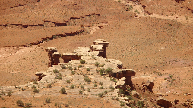
The Rim Overlook had quite a unique view!
Just before turning off to hike the Rim Overlook, two frantic couples and a dog quickly came towards asking if I knew where I was and where I was going. I confidently answered with the affirmative. They said they were lost and didn't know where the trail went. I asked them what map they were using, they replied none, they didn't have a GPS and no written directions. I showed them mine, they looked, they argued with each other, then said they were going back the way they came. The dog refused to move, it sat under a tree. With a big tug, off they went with the dog, were only gone a few minutes when they came running back and said they would stick with me. I told them I still had two more overlooks to do before heading back. They said they were not doing any more overlooks and wanted this to be over with. I sent them off in the right direction never to see them again. I was glad they were gone and to own the place again.
The last overlook crossed what reminded me of a beach.
The view once again was similar as before but from further away. The slickrock top had many pots but because of the lack of rain, only one was filled with water. I took another longer break here because it was almost over and I didn't want it to end.
The last view before arriving back at the Visitor Center was of the snow covered La Sal Mountains. They seem to be everywhere! I was glad I got to do the full loop. I was curious to see what this GPS track would look like. I knew I had hiked in a star-like formation.Because I had started early, it was early afternoon by the time I finished. I covered just over 14km. It was a hot day, I felt the burn on my legs and arms but I didn't want to stop because of that. I packed up, drove back to Moab onto my next adventure.


Excellent photographs and nice story-telling, enjoyed reading this!
ReplyDelete