Saturday, May 12, 2012

Alignment at a Junction

It was time to go back and make things right this time on Junction Hill.   It was the plan all along to and this rock sculpture sitting on my fern table was my reminder.  Today was D-Day (do-day)!  I secretly hoped my stars would align today.  The forecast was for great, there were reports of having no snow to contend with and a few old and new friends were on board to join me.
My preference is to have a stretch of flat to start out with to give all the muscles, joints, bones and heart an opportunity to get in sync but one has to go elsewhere for that.  The ascent here starts immediately and is not gradual, it goes up and up and up.  At least it is on grassy slopes with crocuses here and there. 
Once on the ridge, we could see where we started down below in the bottom left corner. The ridge was snow free and there was a semi-obvious trail to follow along the edge, through trees and around rocks.   
The trail followed right beside two gigantic rocks that formed a window with a view.
Then the first cairn came into very clear view and at this point I could taste summit.  
At this point also was where we saw the most snow but it was not in our way.
After some very, very, easy scrambling then some maneuvering around some big rocks and angled rocky rough sections, we reached the true summit.  It had been about two hours and forty-five minutes since we began our hike so definitely time to sit, relax, refuel, enjoy the views, take photos and celebrate.  Yes, Victory!  Today's summit scene sure beats the scene...
...that we had on March 17, 2012...
We owned the summit for a perfect amount of time and then let the folks coming our way take over.  We aimed for the ridge that would take us on a loop and keep us high.  It was very steep and slow going at times especially over the big boulder field.   I kept looking back to see where we were.
When I looked back this time, it was nice to see some yellow in with the rock and red.
One last look up and back....
....before starting to look down and forward...
This monument marks the start of a very steep grassy slow going descent.
...pretty to our right...
...pretty to our left...
...and very sweet to be back on solid ground heading home...
I'm happy with how today turned out in every way.  In my opinion, I would say my stars aligned today.  I even arrived home tick-free.  There was lots to celebrate today and when there are opportunities to do so, it makes me feel like I am "on top of the world!"

Sunday, May 6, 2012

What's In The Water?

I'm hopeless when it comes to just staying home for a weekend to complete projects or house clean or sort papers or just getting household stuff done!  I managed to do that yesterday but I wasn't capable of doing it two days in a row!  The forecast was fantastic for today and what a great opportunity then to play photographer with my polarizer.  The professional  polarizer people say this filter allows you to see what's in the water so I hit the road very early, headed west to find water and to prove these peoples' point. 

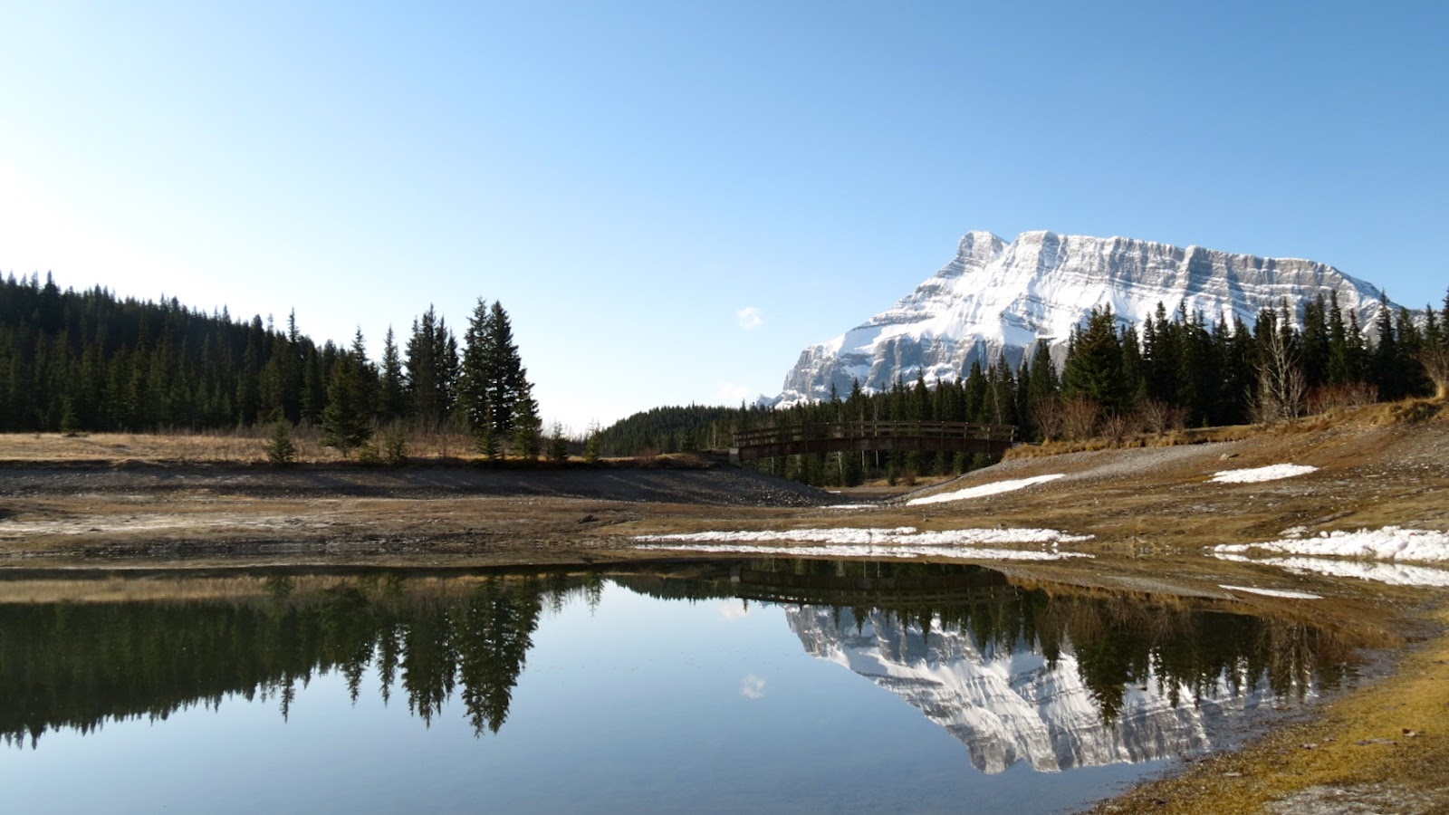
It was early enough that it was just me and the Park Warden at Cascade Ponds just outside the Banff townsite.  I was glad he stayed to watch me seek out what's in the water.  Once I saw this first reflection, I lost my train of thought.  I am a sucker for reflections and forgot to pay attention to the task at hand.  But, as I look at the photo closely now that I am home, not only do you see the reflection but you can also see through the water to the rocks below on the bottom left.  I'm pretty sure this is what the professional polarizer people mean what you can see instead of just a reflection.
I could not resist this reflection shot!  I did twist and turn the polarizer to get that little, tiny cloud in the middle to show up more clearly and hence there it is in the water.
It was time to move on down the road, and the Park Warden had the same thought.  I followed him to Johnson Lake and was glad that he stuck around to watch me seek out what's in the water.  I did bring my bear spray this time though.  There was still a thin layer of ice on the water so due to that my polarizer would not permit me to see what's in the water except only portions of a reflection.
It was time to move on down the road, and the Park Warden had the same thought.  I followed him to Two Jack Lake but this time he didn't stick around which meant I owned this Lake and you know how I enjoy ownership so was happy he moved on.  It was early enough and warm enough and beautiful enough so I chose this spot to have breakfast.  I like how the rocks create a path on the land and in the water.
After breakfast it was time to move on down the road to Lake Minniwanka.  Who should I see, the Park Warden, he was engaging with other folks here but did give me a nod and a smile.  The sun was getting up there and the angles and lighting for a great shot of this Lake were a challenge.  Also, there was no way I was going to be seeing what's in the water here with all this ice.  I could only see what's on the water.
It was time to move on down the road from the National Park to the Provincial Park and what a difference.  Barrier Lake is always a favourite place to stop and enjoy the view whilst having a snack.  No reflections here and no seeing what's in the water but seeing this color made up for it.
Once again no seeing what's in the water at this picnic spot along Route 68.  
But further down the road, and very close to the road, this caught my eye while I was driving.  The color and the clouds captured my attention and I forgot to check close to the edge to photograph the rocks in the water.
In a sense I was successful with the task for the day of using my polarizier to capture what's in the water, it was just that I captured things in the water other then what I was suppose to capture.  Yes, I guess I am hopeless! If being hopeless means a day filled of experiencing views like this then I am happy to be hopeless1

Saturday, April 28, 2012

High and Happy on Hills

Last night when I checked the forecast for today for southwest of Longview, it looked good.  When I checked first thing this morning it looked great.  Then, it took a turn while we were there, it became perfect.  Perfect would be the descriptive I could use for everything about today when we hiked Grass Pass Hills, Boundary Pine Peninsula and Bull Creek Hills.  

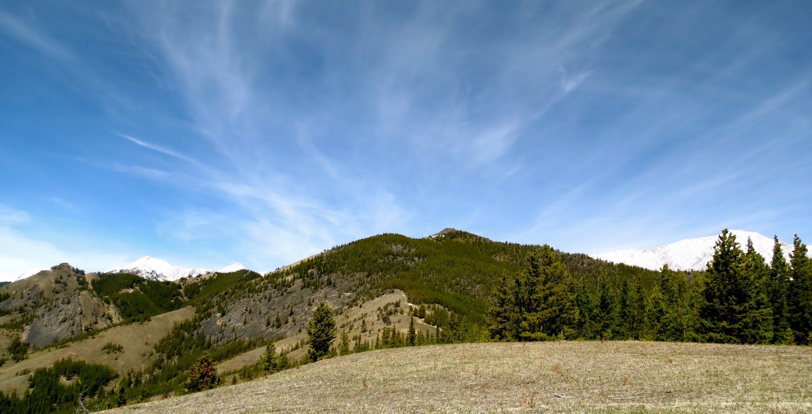
The first great view came when we reached Grass Pass and looked northwest to see Holy Cross Mountain and Mount Head.  I was realizing now, once again my winter hiking boots were too much as were the gaiters and all the upper layers.  The sun felt hot and I was loving it!
We began our ascent up Bull Creek Hills and took the first detour.
The detour along this peninsula lead us to the famous Boundary Pine which added on two kilometers and an hour and fifteen minutes.  I would recommended this detour.  We didn't go beyond the limber pine but the next time up in this area, I will carry on to the end of the peninsula for wide open views into the valley south.
We followed the edge back towards Bull Creek Hills with fine views below.
There were a few short sections here and there of snow to get through before reaching the rocky ridge which would be our summit stop lunch spot for today.  The sun was hot and we were without a breeze to speak off.  I couldn't contain my happiness for life so I'm sharing it with you!
We lingered over lunch, played as photographers and, just plain and simply, thoroughly enjoyed our summit visit.  Now ready to head back, we had a grand view of Grass Pass and the trail that would lead us back down to the trail head.  We planned on more of a steady hike back without the photography stops but that didn't happen, especially when the day looks like this in front of you.....
.....and the ground was covered with crocusus at our feet!
Once off of the wide open slopes and into the trees for the final couple of kilometers through the trees, I looked back for one last look and to say good-bye until the next time!  Yes, I will come back, I have discovered there are more detours out this way that I would like to explore.
While we owned our summit spot today, we didn't own the area.  In just over seven hours spent here, we saw five other folks, two pretty close up for about twenty minutes and three that were specks off in the distance.  Just another reason why today was perfect!

Saturday, April 21, 2012

MORE or LESS

Every single time, the moment I make a plan to play in the mountains, the anticipation for the day takes control!  I always have an idea of approximate distance and elevation numbers and of who I will be playing with but I do wonder about weather forecasts, scenery, trail conditions and will we succeed in reaching our goal!  A high percentage of the time all objectives are met, "more or less".  The odd time the outcome isn't just "more or less" but "so much more and surprisingly less".  Today was one of those odd times!

Our goal for today was to reach the summit of Corral Mountain (unofficial name) southwest of Longview.  It is a remote area, not popular or well known, off the beaten track, not advertised nor promoted, no signs, no trails maps, no official route...I'm sure you get my drift.  Given all the above points was one of the main reasons I was game to venture here and that may hold true for my five friends.  I love going to where we can take ownership for the entire day!  I was shocked and disappointment when a car full of folks followed us to our very remote parking spot and parked six inches away, with all intentions of adventuring with us.  While questioning them, I then realized these were the same people that also were hanging out at our carpool spot the same time we were there earlier and were suspiciously keeping their eye on us.  At the trail head, an explanation was given that we were a small group of six by choice.  Also, for reasons related to safety, experience level, responsibilities, we needed to remain at six, no more or less.  Needless to say, once we hit the trail and looked back, that was the last we saw of that group for the balance of the day which leads me to believe they did not go prepared with directions, nor a map, nor GPS, nor track to find their way.  

We began finding our way with this open fence framing the direction of our destination.  At this point which was just a couple of kilometers along, I already needed to remove a bottom layer and gaiters plus two upper layers.  I had on more cloths then needed and surprisingly it was still only mid morning.  
Quite a bit of time was spent in the trees, route finding, bushwhacking, creek crossing then finally it all opened up and we could see the tower-like thing we hoped to top out at.  There was no snow hardly to speak off the whole way, obviously much less then I was expecting and had gone prepared for.  
As we began the final ascent, the scenery grew to be amazing.   
I find beauty in these ugly, scraggly, dead looking trees.  
We ascended along side the rock face to the col.
The colors were spectacular!
We reached the col and I looked back for a view and a photo before heading on to our lunch spot.   We checked the GPS to see that we covered more elevation than expected already and we had not reached the high point yet.
We enjoyed views in all directions from our lunch spot.  We could see the Hailstone Butte Lookout on the left.  It was amazing how much more snow was just over there.  That cornice was still hanging in there.  
Mount Burke!
After a long lunch, we walked the rocky ridge to the high point of Corral Mountain.  This was as high as I dare go safely.  The one rocky spot that was a tiny bit higher had a sheer drop off at its' side, so I was happy to raise my arms in victory right where I did.
The whole summit area was clear enough of snow that there were no concerns of post holing nor needing micro-spikes, not even gaiters.  It felt like a summer day with the heat of the sun and some greenery.
Mid to late afternoon, we finally began the return portion of our adventure.  Once again we put our route finding skills to use, bushwhacked and tackled more creek crossings.  There were lots of lady bugs around, but I only saw one flower.

I could have used more scenes like this....
...and less like this!
This area was polluted with very old, semi-old and brand new bear tracks.  We stuck together, got a little louder and a bit faster through what looked like a passage way for bears.  Once away from here and onto a more pleasant wide open area, we stopped for snacks.  I took the time to play with my polarizer to see what I could get in return for turning it round and round.   How about a return like this?  I'll take it!
I was expecting to cover more or less 17 km to 18 km but by now we were just about at that distance with still lots to go.  I was very tired, I was thinking don't even think tired, I still had to drive my friends home safely.  I also felt blisters forming on my heels and long before now realized I could have choosen boots that provided less warmth.

I was more then happy to close the gate!  This meant our day was winding down and I was ready for that.  We had one last stretch of road to cover, one last creek crossing, a bit more bushwhacking and thank goodness, we finally had our two vehicles sighting!  The third was gone so that is good to know they found their way somewhere and back safely.
Our total distance and elevation turned out being more than expected.  The amount of snow was less, the clothes and equipment needed were less.  The scenery was much more then I anticipated.  They say "more" is not always better.  I think "more" and "less" were both equally better today.  I truly appreciate those odd days when you are awarded with so much more and surprisingly less