
WARNING: Requires a significant time commitment to read!
Today's hike including the trek up to North Buller Pass, then up to Red Peak then up to the Unnamed Ridge then up to South Buller Pass with lots of downs in between, had been in the making for a few weeks. It would only happen when it was supposed to happen and today was go do it day. Little did we know how extensively our stars would align and what we would be in for. We share this same passion in life being "out & about", embracing every single second and savouring when each sense is significantly satisfied. We experienced it all today!

It was quiet along the Smith Dorrien up from Canmore. I had my camera in my lap ready for action in case there was some action. It was quiet traffic-wise and wildlife-wise it was non-existent. Until as we were nearing the trail head parking lot my friend stated he had not seen a bear this year. I sensed he was envious of my Bearmageddon a few weeks back. As we turned into the parking lot, there was a sense of satisfaction right before our eyes, a big shiny healthy black bear. He eyed us and then went about his business eating everything in sight. We parked the car and began to gear up all the while keeping our eyes on it. He was going no where and we were ready to get going somewhere. He was too close to the roadway that leads to the trail head so we veered off up slope on the opposite side with our bear spray in hand and a couple of times we let him know we were still there. Along came Ms Warden in her truck and wondered what we were doing up on the slope. My friend yelled down to her why we were doing what we were doing. She then went about her business of keeping her eye on the bear. We then came down slope to cross the 742 and went about our merry way up the trail.

our next wildlife sighting within a matter of a few minutes

We talked lots along the forested trail for approximately 4.5 kms until we reached the junction. Then it was time to veer off along the trail that would lead us towards North Buller Pass. It was a gradual ascent at first. We followed the cairns through the rubble.


Time to celebrate success in reaching our first destination.
That's Mount Kidd at the far back right.
We settled in a spot off to the side out of the wind and cold.
We had the first of four lunches here.

My friend captured this photo and shared it with me.
I love how it shows a sea of mountains behind me.


On the back side of the cornice we could now see Red Peak.
It's that high red point on the left.
It still looked awhile away but as it turned out, it just looked that way.

To our left the Spray Lake began to appear.
We could also now see Mount Assiniboine.

These cairns book-ending Mount Bogart are telling us we need to pass through and veer left.

pushing on with the final last shale section to the summit of Red Peak

my friend heading towards that reddish bump thing in the middle

While I was doing all that, my friend scooted off to get some panoramic pictures.

I wanted to be over where he was so then I took my turn.

From the summit we could see the Sparrowhawk Tarns down below through this opening.

he was over there, then I was over there, then we were both over there together
to the left is Mount Bogart then we are between the two Mount Kidd Summits

my Red Peak summit shot

high & happy on Red Peak

This is my friend's summit shot.
You can see the long stretch of the Spray Lake below and behind him.

I signed the summit register which was in a girly looking canister.

It took some time to take care of all the summit business. Next on the agenda was to settle down to dine on our second lunch. This was our view. My friend pulled out his map and we were picking out all the peaks in the neighbourhood. He also picked out all the ones he summited in the past. After an hour on the summit of Red Peak it was time to carry on down and then up to our next destination.

As we were leaving the summit my friend wanted to have a look out over the edge here.
He handed me his camera and he went.
This photo and the next one puts things all into perspective.


view as we ascended the Noname Ridge

ground cover on Noname Ridge

looking back at Red Peak in the middle

Here I am on Noname Ridge in front of Red Peak

looking across at Mount Kidd and Mount Kidd Outlier (reddish part on the right)
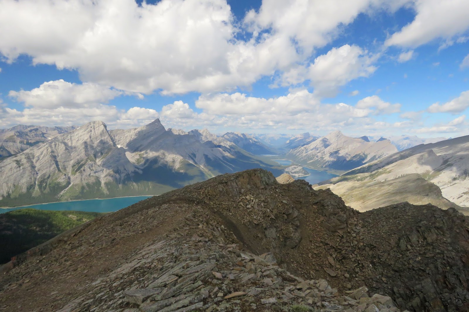
looking down at Ribbon Lake in the middle and a beautiful meadow on the bottom left

mt friend's Noname Ridge destination shot

I wanted the same kind of photo as him.


We still had lots of work ahead of us so packed up and began the descent off Noname Ridge. These guys spotted us and continued to come our way. They were on a mission so we moved out of their way and let them carry on by. We made an assumption these were three teenage brothers.


looking at Noname Ridge that dark topped ridge right in the middle
It was a sweet ridge to hike along.


We watched them head to a ledge and then settled down, maybe for the night.

looking back up at South Buller Pass

It was now time to just get this all over with.
We reached the junction which meant we only had 4.5kms left.
I enjoyed one last view of Buller Creek

What a relief to cross that bridge and be back out on the Smith Dorrien.

We monitored the surroundings to make sure the coast was clear and we continued to do that while gearing down in the parking lot. We saw enough wildlife for one day. No more surprises please, I have no adrenaline left if action is quickly needed. It was heavenly getting my boots and socks off and even more heavenly to finally sit down on the car seat. Sigh! Sigh! Sigh!
After four lunches and a summit celebration and a ridge celebration and two destination celebrations, we still had capacity for more food and more celebration. Sitting at Woody's toasting with a beer in our hands to today's accomplishment was a great last celebration for the day. I devoured the ribs and mashed potatoes. I felt full, I felt pleasant depleted and I now just wanted to be home in my bed! That came just short of two hours later. Today far exceeded my expectations and I feel truly grateful for all we experienced.
Thank you for this day!


