My "B" options were galore! One set would be wintry, the other springy. I did not purposely pick options that began with "B", it just turned out that way. The wintry ones were Boom Lake, Bow Lake, Blueberry Hill. I committed to Blueberry Hill until bedtime last night when I realized I would not be capable of any "B" that was big today. A springy "B" it would be and these options were Butte as in Mesa Butte and Brown Lowery.
I picked the Butte with intentions of some kind of little loop incorporating Mesa Butte and area.
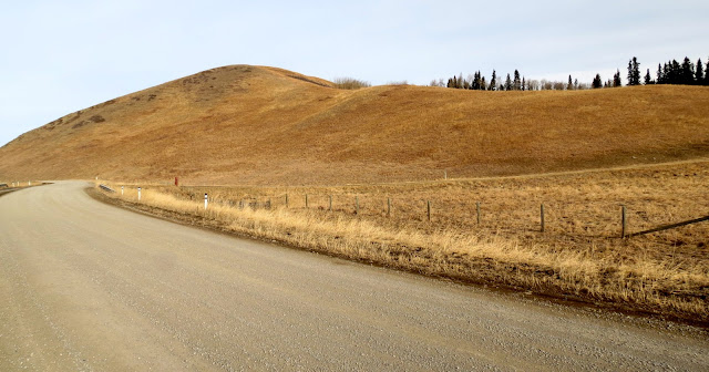
I headed south out of the fog & due west along 549. I was in search of spring-like and found it!
I made it to the Mesa Butte Equestrian Campground, spotted the trailhead across the road that headed into the trees, geared up, waited a few minutes then geared down. It was so quiet which is what I like, not a soul in sight which is how I prefer it. But, I could not bring myself to enter that forest by myself! I could not talk myself into just doing it, I felt bummed!
I got back into my car and headed back east from where I came from.
The fog laid low looking pretty. I pulled over just to admire it and to take a photo.
I wasn't ready to leave!
On my left was a steep open slope along side an aspen forest.
Steep I didn't care for but open I liked!
Up I went!
Easterly View
I made it high enough to where I had an overall view of the winding Threepoint Creek.
At the very top, I intersected a trail which I realized later was the Curley Sand Trail and I was on Curley Sand Ridge east of Mesa Butte. I followed the trail for a short distance through the open aspens but when it entered the denser spruces, I didn't. I turned back! That trail would have taken me to Mesa Butte but I will save that for another day when I can share it with fellow explorers.
This was just one of those days when everything felt off, including myself!
While on the Ridge and eyeing the creek, I made a mental note to check out that creek before heading home. My short hike here did include a loop, at least I had success there. I worked my way back down the steep slope and crossed the road to the Creek. What on earth are these? All sawed perfectly the same size and each with either a blue ribbon or a pink ribbon tied to the metal handle. I wanted one, not sure why, they were cute, but passed on acting on that thought.
Threepoint Creek was...
...frozen and...
...full of reflections.
While my little hike here turned out not being on a "B" named trail, it was a brush with one. Time to move on. Instead of following 549 all the way back to 22, I turned off onto 762 knowing this was the direction I needed to drive to Brown Lowery Provincial Park. Today's "B" appetite still had some emptiness that needed filling.
Once again, I found spring-like!
Spring where I stood, winter where I viewed.
That view above was the only wide open view along the seven kilometers I did here. The balance was along a trail in the forest, by a creek, through a small meadow and over a couple of bridges. This was my first time here, I saw it all and have no reason to go back unless I want solitude and exercise and nothing more. All places serve their purpose and by the time I completed Brown Lowery loop, I felt tired and was ready to head home.


Loved the mist and all the reflections!
ReplyDeleteThose round log pieces look like they could be home-made curling 'rocks'.
ReplyDeleteClayton, now that you mention that, of course it is now obvious. They were sitting right beside a perfect stretch of ice and there was even one out on the ice.
Delete