The plan of attack for today was to hike along EXshaw Creek, then get our EXercise following a trail up the steep slope to EXshaw Ridge, EXplore the length of the Ridge then EXit the Ridge along a defined trail ending up in the town of EXshaw! Remember I said, that was our plan!
Should one take a trail head sign like this to be a sign of what is to come? The sign makers didn't know what to say, or how to say it, or how to describe it, or what direction to go or how many kilometers it was! Good thing we went into this EXcursion with a map and gps and route finding EXperience.
Only one of us was EXpecting many high creek crossings so came properly prepared, and it wasn't me! I need to include a disclaimer here! "Don't follow my EXample of how I EXecuted these creek crossings." It wasn't pretty but I got the job done! These are a few of the crossings. Getting near the last of the creek crossings, I didn't care anymore about getting my feet wet and left my boots on. It was EXhausting me with all the boots and socks off, boots and socks on, boots and socks off and so on and so on and so on!
 |
| Thank you to "Ms D No Stopping Me" for the above photos! |
After approximately five and a half hours and eleven kilometers, we reach the summit of the EXshaw Ridge. It was EXciting to finally be high again and have amazing views of forever. After lunch, we EXplored a bit further along the Ridge and that's where I found a good spot for my summit shot.
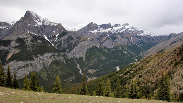
It took longer then EXpected to get to the Ridge and we saw a not so nice weather front coming our way, so we picked up the pace a bit as we carried on along the Ridge heading towards EXshaw Mountain. We were surrounded by mountains, alpine meadows and crocus.
Mount Fable at the left.
I always EXpect to have great photo opportunities on ridge tops and today was no EXception!
I EXpected EXshaw Ridge to be rough and rocky. My EXpectations were EXceeded when we came upon this long grassy (with no snow) section.
As we reached the end of the Ridge, it was later then EXpected, it was pouring rain, some of us were EXhausted so we decided to cut it short and head straight down to the trailhead. As we got closer to EXshaw Mountain, it didn't look as big, so we decided to EXtend our time and distance to include the Mountain. We needed our route finding skills for this steep, mossy, dense, rocky, root-filled slope.
We finally EXited out into the townsite of EXshaw, almost in someones yard, not quite sure of what direction the trailhead was and where we were parked. We figured it out pretty quickly, thank goodness, because I was on the verge of EXpiring! After 10 hours of hiking, the last half in pouring rain, already wet and dirty from all the creek crossings, after brushing off ticks and popping Vitamin I for my banged up knee, I was EXhausted and EXasperated but I could still easily manage a smile! Afterall, I finally got high again after a long time, and I felt like I was "on top of the world!"
 |
| Thank you to Adventure Designer for the above photo! |
Our trail home was through the neighbourhood of EXshaw. I'm sure the locals are use to seeing folks like us walking down the middle of their road but I wonder what they would think if they could hear our conversation!
While we didn't attack our original plan as we EXpected to, we still EXecuted an adventurous EXcursion!


No comments:
Post a Comment
I'm always curious to know what your comment might be!
Note: Only a member of this blog may post a comment.