Sunday, August 25, 2013

Wilcox Pass August 25, 2013 Day 1

My original plan was to hike Wilcox Pass tomorrow and Parker Ridge today but of the two Wilcox is my favourite and I wanted to make sure I had favourable weather conditions for it so that meant hitting it today as tomorrow calls for not as nice.  My belief that everything happens for a reason was reconfirmed by this change in choice.  That story plays out on my Parker Ridge hike so stay tuned for that, but for now, join me along Wilcox Pass. 

It took me just short of four hours to get to the trail head this morning and I was in desperate need to stretch my legs, breathe, and just let go and go with the flow.  Having been here two years ago, I knew what I was in for and could hardly wait to receive that.  I darted through the forest to quickly get to this!
...and then this!
Before this, I spent a little time at the top point of the Pass then followed along the trail heading through the meadow towards Tangle Falls  with a view like this for the entire time.  This time I did not go as far as before because I wanted to venture off in a new direction instead.  I hiked a kilometer further beyond this and then turned around.  
Heading in the new direction would bring me closer to the glaciers.
My view on the way closer to the glaciers.
zoomed in shot of glacier
Not zoomed in!
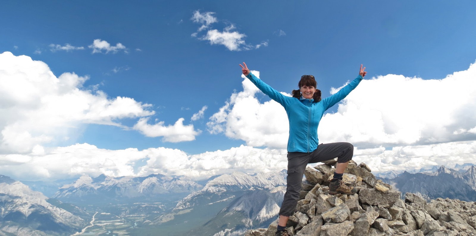
At my new destination and the perfect spot for a summit shot.
The Icefield Parkway Center is below me and this was my lunch time view.
Looks like he is full from lunch.
Looking back to where I just was. 
There is still more area to discover along Wilcox Pass which means I will just have to pay another visit another time.  It was a wise choice to hang out here today, the weather was ideal and the scenery spectacular.  It is so easy to place this place on the top of the list for being amazing.  

Before checking in for the evening, I drove out to Abraham Lake.  
Abraham Lake
After all the driving today, the hike, the scenery, fresh air and exercise, I was beat!
I was fine ending the day on the earlier side.
I could not truly appreciate anything more to love on this day!

Saturday, August 17, 2013

Then & Now WOW

Secretly I considered today's trek to Cirque Peak to be a reconnaissance visit for purposes of measuring confidence and growth.  I ventured into this area back in 2009 when I was quite the novice with regards to steep slopes, scree, finding my way mentally, scrambling, loads of elevation and just plain hiking in general.  On that day in 2009, summitting Cirque Peak was such a boundary breaker for me that I uncontrollably had a moment behind my sunglasses sitting on the top with what looked like the whole world below me.  And so, the evaluation began...

My hopes were to find a few friends to join me and there was no reason to doubt that would happen as the word is out there that this place is A-1, premier, golden, prime, you get where I'm going with this.  Before all this good stuff, you have to first work your way through the forest.  Then...turn the corner...exit the forest...hold your breath...then remember to breathe!

Cirque Peak, our destination, is top right!
Along the way to Cirque Peak you have to pass by Helen Lake.  
This spot is a premier destination on its own.  
We spent a little time at Helen Lake to rest and refuel then get in gear to go for the summit of Cirque Peak.  First, we gained the ridge above the Lake, then passed through a short easy fun scramble section.    After that, the trail was clear as can be in front of us which is that light colored line straight up through the center.  It was steep, it was slow going, it was slippery.  Just before successfully summitting, the dark clouds rolled in, the wind picked up, and the rain rained down on us.
We only stayed long enough to secure our individual summit shots.
That is Bow Lake behind me.
The descent was easier then the ascent.
The view of the valley below where we were headed was expansive and priceless.
See emerald Katherine Lake lining the base of the Dolomites.
Conditions were not ideal to dine on the summit. 
We found a sheltered spot amongst a rock garden by a lakelet low down to hang out for awhile.  
This was one of our lunch time views. 
pretty & perfect
There is a piece of my heart near Helen Lake so I must return to collect that to fill this void.  
When the time comes for the retrieval, I will wish for a sunny sky...
... and time to enjoy massive views from the summit.
After lunch, we continued along the ridge and then veered off towards Helen Lake below.
We agreed to carry on past the Lake and make our way along the last six kilometers to the trail head. 
This is one last, vast view before heading to the forest.
Four years and a month later, I completed the trek to Cirque Peak, and I am proud to report my own measurement rating for improvement is " she has grown by leaps and bounds".  I was happy to have friends to share today with and glad to have made two new friends.  Being with these upbeat, happy folks in a place like where we were today, helps to make me feel like I am "on top of the world"!  


Saturday, August 10, 2013

Getting High & Going Low

I had not been on the Smith Dorrien since January 26, 2013 for a Chester Lake snowshoe outing and May 11, 2013 for a trip up Ha Ling Peak.  Now that the trails along the 762 are opening up after the devastating flood, it was time to take a break from frequenting National Parks and pay a, long over due, visit to a Provincial Park.  Spray Valley Provincial Park was calling and to be more specific the call was coming from high up on Buller Pass and from way down low at Ribbon Lake.   I decided to answer the call!  

The area received a prescribed burn in 2011 which changed the landscape throughout the forest and the June flooding changed some landscape in other areas.  I had been to Buller Pass five years ago and I don't remember feeling like I was at the beach.  A stretch of trail reminded me of when I was a kid walking along the sandy path that was lined with beach grass on the way to Melmerby Beach.   
After a few kilometers in the forest, then through the sub alpine meadow, we climbed the steep rough and rocky slope up to South Buller Pass.  There was evidence of erosion along one section of trail on the way up  as was the same through gullys in the mountains.  I wondered how stable was this rock surrounding us. From Buller Pass, I could see back from where we just came.....
....and ahead to where we would be going.
You can see Ribbon Lake tucked in the middle left.
Guinns Pass is the dip on the right.
Weather was on our side for our summit lunch time visit.
It was warm with no wind nor bugs.
Before dining, I captured my summit shot.
See Ribbon Lake glowing emerald like?
It was quite a steep descent from The Pass to the valley below.  The trail was full of lots of small and large loose rocks plus bare slippery sections.  The wild flowers were wonderful throughout the area. The ground cover was such a super lush vivid green.  Parts of the trail were well grown up and the tops of the vegetation were waist deep at times.  
Evidence of erosion!
I was surprised to see what fierce rain could do to a trail.
Yes, it did make me sad!
Finally, Ribbon Lake and scattered rain showers!   The sky was threatening for awhile but when it came down to coming down, it did not amount to much and there was not even a need for protective layers.  Lots of folks were at the Ribbon Lake Backcountry Campground which just opened yesterday.  
We walked around to the far side of the Lake, to a high spot which was the beginning of the Ribbon Creek Trail where you descend to the chain section and then to the bottom of the valley which is heavily damaged and officially closed.  We spent some time here enjoying the views.  On the way back the sky cleared somewhat and the reflections were much brighter.
colorful reflection
This was one sketchy section we had to maneuver along.  The right side of this creek back a bit was worse in spots and we had to move up slope a little to safer ground to get forward before moving back down to the creek to cross over.  No stepping on the right side of the trail here.  The ground was loose but sticky.   
Back through the flowery meadow..
then back up that steep rocky slope...
all the way up to Buller Pass again!
I found it tough....
and worthy of another summit shot!
Look at the profile below, yes, we summited Buller Pass twice.
It was all down hill now, or I should say all down mountain now.  
It was a loooonnnng trek back to the trail head.  
Down the rock section again,
by the sub alpine meadow again, 
through the burned forest again! 
A friend shared bottles of cold fruit flavoured Perrier water with us when we arrived back at our vehicles.  It was refreshing!  The whole day was refreshing, being back in a Provincial Park, seeing a different landscape, appreciating the hard work that has been done by volunteers to make our trails accessible again, and also catching up with friends.  

Refreshing!  Rewarding!  Rejuvenating! 
It is "Re's" like these that make me feel like I am "on top of the world"! 


Monday, August 5, 2013

I Sensed You Were Someone Special

During the past year, there have been a few occasions where through hosting "Making Waves" I have been stopped in my tracks and experienced an "oh my gosh" moment.  An out-of-the-blue email that I received last evening was the beginning of exactly one of those "oh my gosh" moments.

In two weeks, it will be two years since I spent two nights at the Elizabeth Parker Hut at Lake O'Hara in Yoho National  Park.  This was my first ever experience staying at an Alpine Hut of Canada.  Being a beginner at this, I was green about everything and a tad nervous.  It was intimidating being amongst the very experienced.  

My first morning there, I woke so very early.  It was still dark, I had enough sleep, I could see a small light through a crack in the door, some one else was up in the kitchen.  I quietly got out of my sleeping bag and tip-toed my way to the kitchen.  A petite lady with an angelic look was busy sorting water buckets, boiling the water and pouring it.  I was desperate to have my morning coffee but had no idea about the water purifying system nor the color-coded bucket system.  She told me she was preparing enough water for everyone for the day and she pointed to the safe water I could use to make my coffee.  She spoke very quietly and softly and taught me the coding and purifying system.  

We chatted about being morning people and how we just wanted to get up once we woke up, and get on with our days.  She told me how she loved the peacefulness of the early morning. I sipped my coffee as we chatted and she continued on preparing water for everyone.  I remember looking at her and wondering how can someone be so vibrant and glowing at this hour of the morning out in the wilderness!  We chit-chatted a bit more sharing a few more thoughts then I went on with my day, and she went on with hers.

We never did exchange names.  

Beginning with that out-of-the-blue email I received last evening, and a few more back and forth emails last evening and this morning with an acquaintance, now two years later since being at that Alpine Hut,  I now know that soft spoken, angelic lady who I shared the peaceful early morning with and who taught me all about water sorting and purifying was Michelle McNeill.   You were taken from your mountaineering friends and family much too early!  May you rest in peace!

Yes Michelle, I will choose my steps carefully!


Saturday, August 3, 2013

Not Just Grand, but GRANDEUR

The distance and elevation of my recent hikes have been grand, so now is the time to up the ante and go for grandeur!  At a distance of 24 kilometers round trip and total elevation gain of 1500 meters, Mount Bourgeau is as grandeur as it gets.  A few others were ready to go for grandeur with me and I was happy to have their company.

The trail head is not that far past Banff Townsite, so not a size-wise grand drive but always grand scenery-wise. The first seven kilometres from the trail head is a gradual climb through the forest without much in the way of sights to see.  Once it does open up, it stays open and pretty all the way to the summit.
The first stop is at Bourgeau Lake.  
Half of the elevation is done by the time you reach here.  
It's the ideal place for a short break and to fuel up.
While the scenery was pretty, the bugs were not.  
The wild life was cute, yet pesky.
Just past Bourgeau Lake was when a full view of Mount Bourgeau came into sight.
Wild flowers were in abundance.... 
....and so were lakes and lakelets.
Harvey Pass is a beautiful place to be and some folks make that their destination.  
This Pass has everything!
A meadow of rocks of all sizes, shapes and colors.
Harvey Lake is, of course, at Harvey Pass.
Harvey Lake from one side...
...to the other!
Mount Assiniboine sits center at the back.
Also from Harvey Pass is where you can see the last long stretch to the summit!
View from along that last long stretch.
Before I did anything, I made sure to secure my summit shot!
Then it was time to relax, breathe, dine and enjoy the fine lunch time view right before my eyes.
Feeling refreshed and full, we packed up and hiked over to the oppsite side of the summit for another summit shot and more views.  After 45 minutes on the top of Mount Bourgeau, we began our descent which would be long and after a few kilometers there would be the need to dig deep, forge on and just get the job done.
This is my final photo of the day.  Conditons were perfect for a mountain reflection in the lakelet.  Yes, reflection!  Today was quite the accomplishment and it will be one I will reflect on for time to come.  I had some slight concerns about how today would turn out.  I wanted to have ideal weather which we got, I was not sure about trail condtions and those turned out to be perfect and I hoped my friends would have determination and guts to enjoy the glory and each one certainly showed me I was crazy to have even thought it could possibly be otherwise.  Reflections! Scenery! They were grandeur!
I felt like I was "on top of the world" today!