Sunday, August 5, 2012

Waterton Lakes National Park Day 3

Day 3 arrives in Waterton Lakes National Park and we are up the creek without a paddle!  We had to check out of the hotel with no place to stay for tonight.  We had a plan in place though.  Last night we packed up our stuff and put it in the vehicle to assist with a quick get-away this morning.  We hit the road at 6:00 am with hopes of being early in the line up to secure a Sunday night camp site at the Campground.    I couldn't help it, I had to stop along the way to take a photo of the alpenglow  
We arrived at 6:15 am to find we were first!  Fifteen minutes after we arrived, a car left and the passengers deposited their receipt in the drop box which meant we had a campsite and a place to lay our heads tonight.  Even though, we still had to wait for the attendant to start work at 8:00am and assign us the site.  

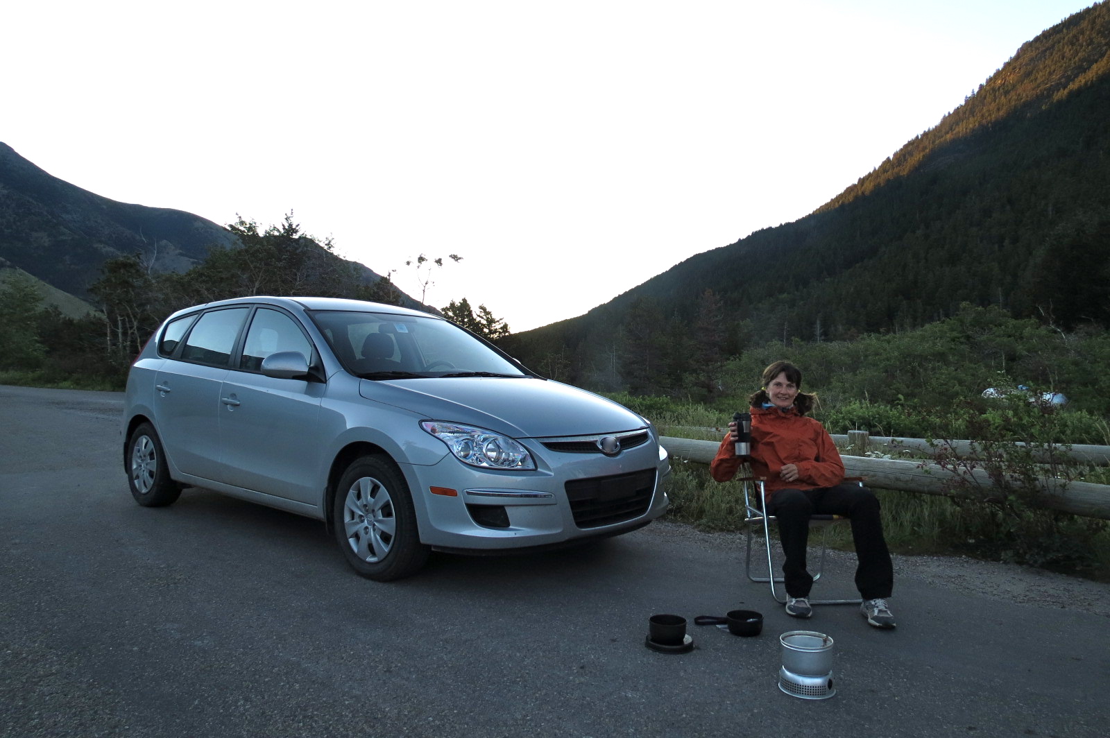
We passed the time making coffee and breakfast and getting our gear ready for today's hike.
By 8:30am our campsite was set up.
Our intentions were to hike Linham Ridge but we ended up doing Linham Creek Trail instead. Thank goodness it worked out this way.  With today's blazing heat (already mid 20's by mid morning), it was not the day to be on the wide open Ridge.   We reached the trails end, had a snack, admired the flowers and the view and then did an about face and retraced our steps back to the trailhead.
We drove down the road and found a shaded spot by a creek to cool our feet and have lunch.
By late afternoon we were back at our campsite enjoying snacks and drinks, socializing with other friends then having dinner and more drinks, sitting by the campfire, then ending our day watching the stars come out. 

Saturday, August 4, 2012

Waterton Lakes National Park Day 2

We knew this was going to be a fabulous day when 15 minutes into our drive to the trail head for the Akamina Ridge hike, a young black bear jumped out from the bushes in front of our car.  We did not pull out to pass because he was wandering around on the road and we thought maybe Mommy would jump out also. The little bear looked lost and didn't know what to do.  It eventually climbed up and over the guard rail and off it went.  We never did see the Mommy.  We took this as a sign that we were in for quite a day and also this was our reminder to put our bear aware knowledge to work as we hiked.
Our hike began in Alberta and shortly thereafter we  crossed over into British Columbia.   
The temperature was rising quickly and it was nice to arrive at Forum Lake to cool off by the water.
It wasn't far from here where the climb started and then the climb turned into easy scrambling which I was fine with.  It was the moderate scrambling section which came next that I wasn't fine with and needed assistance.  That assistance came by way of pushing, shoving and pulling from my friend and two elderly ladies who happened to have a  wealth of scrambling experience and patience. I have no photos to share of this portion of our hike, my mind was elsewhere!  But I have this photo, our view once reaching a safe flat area.  That is a portion of Akamina Ridge that we will be hiking along and Wall Lake down below where we will eventually end up.
Once safely above and beyond the rockband, I was able to fully enjoy the views around me. I was realizing now why this is rated as "Premier" by the Copelands in their book "Don't Waste Your Time in the Canadian Rockies."  The summit of the Ridge is on the tip of that redish pyramid shaped thing.
My summit shot proves I made it to that redish tip only to see we needed to loose elevation before working to gain it again to reach the next redish tip which is behind me to the right in this photo and is the second of four bumps that we need to ascend.  Before heading there, we settled in on the side of this peak to enjoy snacks and scenery.
This is our snack time view.  We started our hike in Alberta, Canada, crossed over into British Columbia, Canada and then ascended to a height where we had a view into Glacier National Park in Montana, United States.
A glacier view.
We were fortunate to experience only warm breezes up here.  I hear this is not normal. This Ridge is known for very strong cold winds.  But like I said, that baby black bear was a sign we were in for a spectacular day. Akamina Ridge went on and on and on, and up and down and up and down and up and down all the while having views of forever.   This photo gives an idea of the angle of the slopes that we hiked up and down.
After coming off the fourth and final bump, we had an amazing view of Wall Lake down below.   
You can also see the beige line along the edge of the bump, that was our hiking trail.
From Bennett Pass, we could see the whole length of Akamina Ridge behind us.
We made our way off the Ridge to the valley below to finish off the hike which was still many kilometers to go.   The wild flowers were in abundance but I didn't spend much time capturing physical images.  I had a mental image of the trail head and that was the only place and thing I wanted an actual physical image of and I wanted it sooner then later.  When we had our visual of the end, we went for a high-10 instead of a high-5.  
I was quick to collect my Peakery badge for Akamina Ridge.   Some of these badges come easily but this was one I truly had to earn.  I proudly display it here!  I have completed many amazing hikes in my life and this one has taken over the top spot.  Getting through that moderate scrambling section and finally standing on the summit, I felt like I was over the moon, my stars had aligned and like I was "on top of the world!"

Friday, August 3, 2012

Waterton Lakes National Park Day 1

It pays to be resourceful, flexible and determined.  After arriving in Waterton at 10:00am, we headed straight to the campground only to find out we were #33 on the wait list for a campsite.  The Warden said it would be in our best interest to immediately get going in search of another place to stay other then any close by campgrounds or hotels in Waterton.  We figured it didn't hurt to check out Waterton first,  lucky for us we were able to secure a room for two nights and I could use the certificate I won in February to cover a portion of the cost.  

We quickly checked in and then just as quickly, headed out the door to begin our hike .  We picked an easy hike as by now it was already noon time.  We hiked across the town site then started up the trail to Bertha Lake.  By now the rain turned to drizzle, the temperature began to rise and the sky started to open up but only a tiny bit.  The trail in areas was lush, over grown and by the time we got to the other end of this section, we were totally soaked from the moisture on the bushes.
Bertha Lake

We veered towards the right side of the lake to an open area with a view to have our lunch.  We did not proceed beyond this spot nor did we hike around the lake nor follow the left side.  All folks returning reported brand new bear scat and prints.  We put our bear aware knowledge to work.  This was our very late in the afternoon lunch time view at Bertha Lake.
After lunch, we returned to our room, cleaned up, and headed off in the early evening to secure a dinner site.  This is it!  We toasted to our day and to the days to come then settled in to enjoy a fine dinner with a fine view.
The Prince of Wales Hotel sits on the hill just behind us.
We watched a rescue off Bears Hump.
We enjoyed the sights as the sun set.
I was thankful for my friend being relentless in making sure we found a place to lay our heads tonight.  
We did some pre-organizing for our big day tomorrow, then called it a day.  

Saturday, July 28, 2012

I Need To Go Again

As you can see from my Peakery Badge, I have been to Paget Peak twice.  
I need to go again! 
I am not sure when that will be, but it will be!
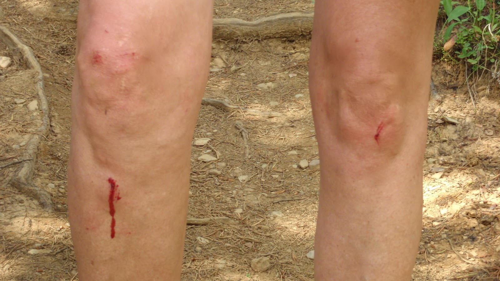
The first time we unknowingly only made it to the false summit and I came above bruised and bleeding.  Today we made it a little further to the true summit but yet, I still came away bleeding and bruised.  My goal for the yet to be third time is to go further then the true summit to where the truly gorgeous views are and come away unscathed.  

We started the day bright and early with bright skies.  
It didn't take long to get to Paget Lookout.
The higher we went along the steep section, the bigger the views became.  
This is looking west towards Field down in the valley.
A full view of Sherbrooke Lake came into sight.
We are warned that somewhere down there roams a grizzly bear.
We did see recent diggings along our trail.
We reached the false summit under dark clouds, light sprinkles, strong winds and a cold temperature.  I came prepared to celebrate and no matter what, that was going to happen as this year is a special one.  So here I am on the false summit with one of a dozen "Bliss" mini cupcakes.  Mine was chocolate with green mint flavoured frosting on top decorated with a blue candle.   Thank you to my friends for sharing today with me!
The Peak was colorful and rocky!
We cut our lunch break short as the weather was deteriorating and we wanted to make sure we at least made it to the true summit.  You can see the summit canister at my foot.  If you reach the true peak be sure to peek in the canister.
The views were great from here considering the weather wasn't.  A little further along this trail though, I hear the views grow from great to spectacular.  Mount Niles appears to be surrounded by a collection of new snow.  
Three times here will be the charm!  
The following sights are not charming!
War wounds acquired on August 13, 2011.
War wounds acquired today!
The descent off Paget Peak was slow going over scree, big rocks and through a boulder field all the while raining, changing to light hail then to sprinkles and when we arrived back at the Lookout the sky cleared, it warmed up, we dried off and landed back at the trail head pleasantly depleted.  It was such a treat to get the socks and boots off and change into clean cloths for the long drive back to the city. 

When I reflect back on today, I was glad to be able to share it with some old friends and to make some new ones.  I have been lucky to experience some wonderful adventures this summer and there are still more to come that have the potential to be bigger and even better.    I feel like I am the luckiest girl on earth these days!

Saturday, July 21, 2012

Talk About Being Long!

I made it official very early in the week that I would be hiking the full Mist Ridge Rickerts Pass Loop today and the effect I felt from the early declaration was that it made it seem like an extra long work week waiting for Saturday to come!   I had done a portion of this hike a few years ago but I had heard the part that I didn't complete was the most beautiful so I just had to go back and prove my source right.
We had a very early start to our day and that is just how I like it this time of year.  We were first in the parking lot trail head and first on the trail and saw only a dozen or so folks the balance of the day.   I don't understand why this is not a busy place but I sure like that it isn't.  When we finally got out of the forest, the views were spectacular immediately as seen in the photo of Mist Mountain below.
On the slope heading towards the south summit, I spotted these golden spotted eggs in a tiny nest nestled against a rock. If I had been a foot or two on either side of where I was, I would have passed right by.  I have no idea what they are. 
The south summit at 2432 meters.
View as we hiked along Mist Ridge.
There are lots of ups and downs on this long ridge.  We could see our last high point which is the north summit at 2515 meters.  It is the last beige bump and it looked like we still had a long way to go to reach it.
Two of my friends enjoying the Ridge top.
We reached an opening through a valley between two mountains and this is what we saw!
Calgary is a long distance away but it doesn't look like it here.
We made it to that last beige bump which was the highest point on Mist Ridge so this is where I choose to have my summit shot taken.  The long valley far below and behind me was an amazing sight to see.
We began our descent and headed towards Rickerts Pass.  I looked back to see a short portion of the long ridge that we just hiked along.   The tiny dots on the far right side of the ridge are two folks who also came to unbury this treasure.
We reached the official Rickerts Pass and wondered what this cross stood for.
Would any of you, my followers, know?
Every time I am out and about in my playground, I am thankful and very appreciative that I have my health, the time and the little bit of money that it cost to be able to enjoy what truly brings me joy.  Out of all those times, every once in a blue moon one of those times feels extra special and that was the case today.  I can't exactly put my finger on why those once in a blue moons happen, but when they do, I feel like I am "on top of the world!"