Sunday, May 16, 2010

Emerald Pools (May 10)

THE EMERALD POOLS

I needed to do an easy hike this morning to save myself for this afternoon. One of the hikes those in the know say not to miss is The Emerald Pools. They seemed more golden to me then emerald but still very pretty. The trail started across the bridge from the Zion Lodge.
I decided to go the easier way which was counter clock wise. I only found that out as I was descending at the end of the hike. My way was an easier ascent. Once the climb started, it was along stairs. The trail conditions everywhere amazed me, they were so well manicured and maintained.
The pools were just that, small pools. The first one seemed more like a puddle. This amazing water fall flowed over the ridge above onto the ground. The mist was refreshing from it on an already warm morning.
I was confused on where the second pool was. I may have been expecting something bigger but didn't find anything that I would call a pool. I continued on to find the third pool. The trail was a little rockier and steep for some folks. I guided a couple along who thought it might be too much for them only to find out they were absolutely fine. It was well worth the effort!
They say third time is a charm! Well, this third pool was a charm! See what I mean by golden? I'm sure those with fancy dancy cameras would get amazing photos here. The lighting was so different, I didn't know what setting to use.
A Charm!
I shared my thoughts with everyone here and left my mark before I had to begin my trek back to the trailhead. This was a quick hike, just under two hours and I covered 4.7 kilometers. Elevation was minimal at 250 meters. I could not pass up taking this photo! Not only was the third emerald pool pretty, so was the scenery along the ridge to and from the pools.
I relaxed at the Zion Lodge for awhile and ate my lunch before getting the shuttle into Springdale for my afternoon adventure.

Saturday, May 15, 2010

Riverside Walk (May 9)

THE RIVERSIDE WALK

I really wanted to hike The Narrows while I was in Zion but conditions were too dangerous and it was closed. The river was flowing at 400 cubic feet per second and they only open it for hiking when it flows at 140 cubic feet per second for 24 hours straight. They say it is usually open by the middle of May but the way it is looking it could be the first of June this year. The Riverside Walk is a beautiful trail about 3km in distance round trip, which follows the river and leads to where the river hike would start.
There were trails off the main one, that led to the river to get a closer view and a sense of how strong and mighty it is. I can only imagine how beautiful the canyon walls are further down the Narrows.
You don't want to get in the way, the river takes no mercy and will take with it whatever it may!
At the far end of the trail are stairs that lead into the river to start the hike when it is safe.
I wanted to put my feet in The Narrows! For as long as it takes to have my picture taken, I stepped in! It was strong and very cold!
I can't say I hiked The Narrows but it did caress my feet!

West Rim Trail (May 9)

WEST RIM TRAIL

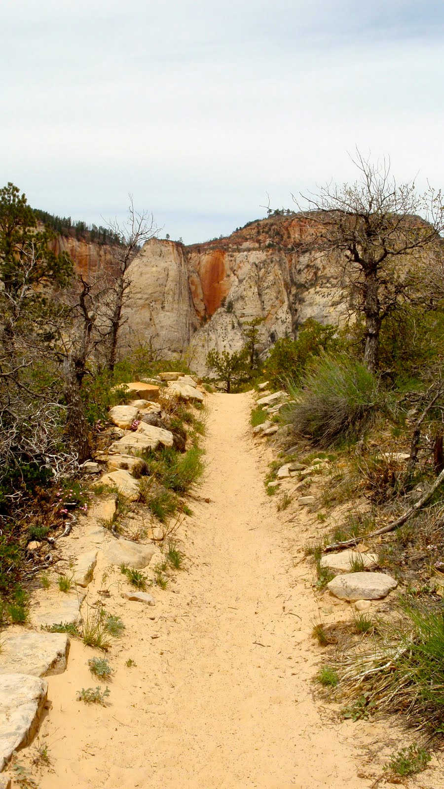
After coming down off of Angels Landing to Scouts Lookout, I rested for a few minutes had another snack then carried on along the West Rim Trail. This is a long backpack trail with campsites further along the way, but those in the know suggest this is a good hike for a few miles out and back. These sandy trails feel good on the feet and knees but they sure give you a workout.
Before I turned the corner, I looked back to see Angles Landing. I am glad I didn't have this view at the first, I may have been deterred from making an attempt.
The pathways are colorful as are the surrounding mountains. Heading in this direction has a whole different look.
There are more grey colors and unusual formations.
It is also very hot by now! I had to put my new hat on! Glad I took it with me! This is a part of the trail, and the sign to my left marks the way. It has a foot print on it. These guided you along this portion.
In amongst all this rock, there is life!
The flowers were pretty and plentiful!
I did roughly two kilometers out and decided to make this my destination on the West Rim Trail. This distance brought me down one side, across a canyon creek bed and up the other side around into another canyon area. It was a quick trip back to Scouts Lookout, another rest and then down those Water's Wiggles, Refrigerator Canyon and the switchbacks back to the shuttle bus where I hopped on to head to my next destination.

Angels Landing (May 9)

ANGELS LANDING

I was so excited to be attempting Angels Landing today! I was warned to get an early start to avoid the heat and the people that come with a later start. I was at the trailhead by 9:15 along with a handful of others. I let them get out of the way, I wanted to take my time and not have others breathing down my neck. Once they were around the corner, I took this shot!
The climb started right from the get-go and it warmed up right at the get-go! I slowly made my way up these switchbacks, trying to adjust to the heat, enjoy the scenery and take photos.
I was thankful for Refrigerator Canyon at the top of the switchbacks. It was very cool but no way was I putting a layer back on. I grinned and bared it!
I actually giggled at Walter's Wiggles! As I was going back and forth winding my way around and around, I looked up and saw tops of heads going back and forth and back and forth and back and forth! It looked so funny! They looked liked bobble heads bobbling along! I am part way up here looking back down at those behind who already reached the summit and are heading back.
At the top of Walter's Wiggles is Scouts Lookout, the majority of hikers make this their destination and go no further. This is what faces you! It is a very narrow, steep, slippery, sandstone ridge that you need to climb with the aid of chains if you want to reach Angels Landing.
This is the base of the steep section!
I wasn't sure if I could do this but I knew I had to at least attempted it! First, I took a photo of the road below me.
I took my time on the chains. I needed to hold on with both hands to feel safe, and watched every foot placement. I'm not use to hiking on sandstone stuff like this. I kept my eyes in front of me and after about 30 minutes or so, I reached the top! I moved to a flat safe area and had a moment behind my sunglasses. When I looked around, I couldn't believe the beauty! I could not believe where I was! The Canyon is vast and so far down!
I asked a fellow to take my summit shot! He was solo too, so I offered to take one of him. He stood there, I said "is that it?" then he raised his arms in victory and beamed just like me!
I tried to imagine what this hike would be like, but it far exceed anything I could ever imagine and I have quite the imagination too!

These are my stats for the Angels Landing hike and the West Rim Trail which I carried on with when I reached Scouts Lookout.

Springdale, Utah (May 8)

SPRINGDALE, UTAH

It was close to 5:00 when I finally arrived in Springdale, Utah which is at the doorstep of Zion National Park. I was glad the speed limit was only 35 miles because I had a hard time paying attention, and was looking around in amazement at the scenery and the road color. They matched! I'm all about matching so I felt welcome and knew I would fit in.
This would be my home for the week! The Bumbleberry Inn!
I had a ground floor room with a patio that faced the setting sun and this is where I sat in the evening and enjoyed a nice cold Polygamy Porter Beer. I didn't have just one!

I was really pleased with my room and the location. Sol Foods was right next door, that's where I got my beer and some groceries to make my breakfasts and hiking lunches. The free shuttle bus to Zion and all the trailheads was a 1 minute walk from my front door. Yet, it was the view that had me hook, line and sinker!
After dinner and a beer, I walked Zion Park Blvd which is the main drag before heading back to unpack and make a plan for the next day.

The Adventure Begins (May 8)

THE VALLEY OF FIRE

Even though I live in Calgary, I am by no means a big city girl so I could hardly wait to get off the plane in Las Vegas, hop in the rental Mazda 3, hit the freeway and escape to begin my adventure. I consider the beginning when I turned off the I-15 onto this long and winding road that took me through the Valley of Fire State Park in Nevada on my way to Zion National Park in Utah.
Not long down this road, after many stops, my thoughts were leaning to, did I book enough days away, it's hot, will my camera card be big enough, it's hot, at this rate I will never get to Springdale and it's hot! This Valley was living up to its' name.
I pulled off at all the pull-offs and drove down all the roads there were to drive down. Each area had something unique, for example these are called beehives.
Another area had pretty flowers and cactus!
It was this road and this scenery that got me into vacation mode and I was ready to get to Springdale to check in and set up my home away from home.

Tuesday, May 11, 2010

Mount Carmel Highway (May 11, 12)

MOUNT CARMEL HIGHWAY

Lucky for me, construction on the Mt. Carmel Highway won't be starting for another week, so I got to drive this route on my trip north to Bryce Canyon National Park for over night. Unlucky for me, the weather was terrible and for views, well they were limited, in fact, there were none!
Lucky for me, because of the weather there was no traffic at all and I could drive slowly and safely along the narrow wet road with steep drop offs.
As I got closer to Bryce National Park, I noticed the temperature gage in the car drop. I was prepared with all my layers though so that wasn't an issue. The break from the Zion heat was welcome. I spent the night at Ruby's Inn in Bryce City and retuned the next day. Lucky for me, the weather changed and I had gorgeous views on the return trip. This is the Checkerboard Mesa.
This is a view of the road below, where I will be in a few minutes.
Here we go again, matchy matchy! I love the shades of color in Zion National Park.
The long tunnel was backed up as large vehicles were being escorted through from the other direction. The Mt Carmel Highway was very busy, very scenic and I am glad I got to see it and drive it.

Monday, May 10, 2010

Observation Point and Hidden Canyon (May 13)

OBSERVATION POINT

I tried to get an early start today but it was slow going once I got out of bed! It was closer to 9:30 when I hit the trailhead and not long after I was down to my short sleeve shirt. The climb started immediately with switchback after switchback after switchback. The trail got you high up pretty quick with amazing views. After a couple of miles, I reached Echo Canyon. It was gorgeous! The trail went right through it and opened up to more climbing and breath-taking scenery.
The coloring changed once out of the canyon. It had yellow golden shades.
Then not long after, it changed again to the Navajo sandstone.
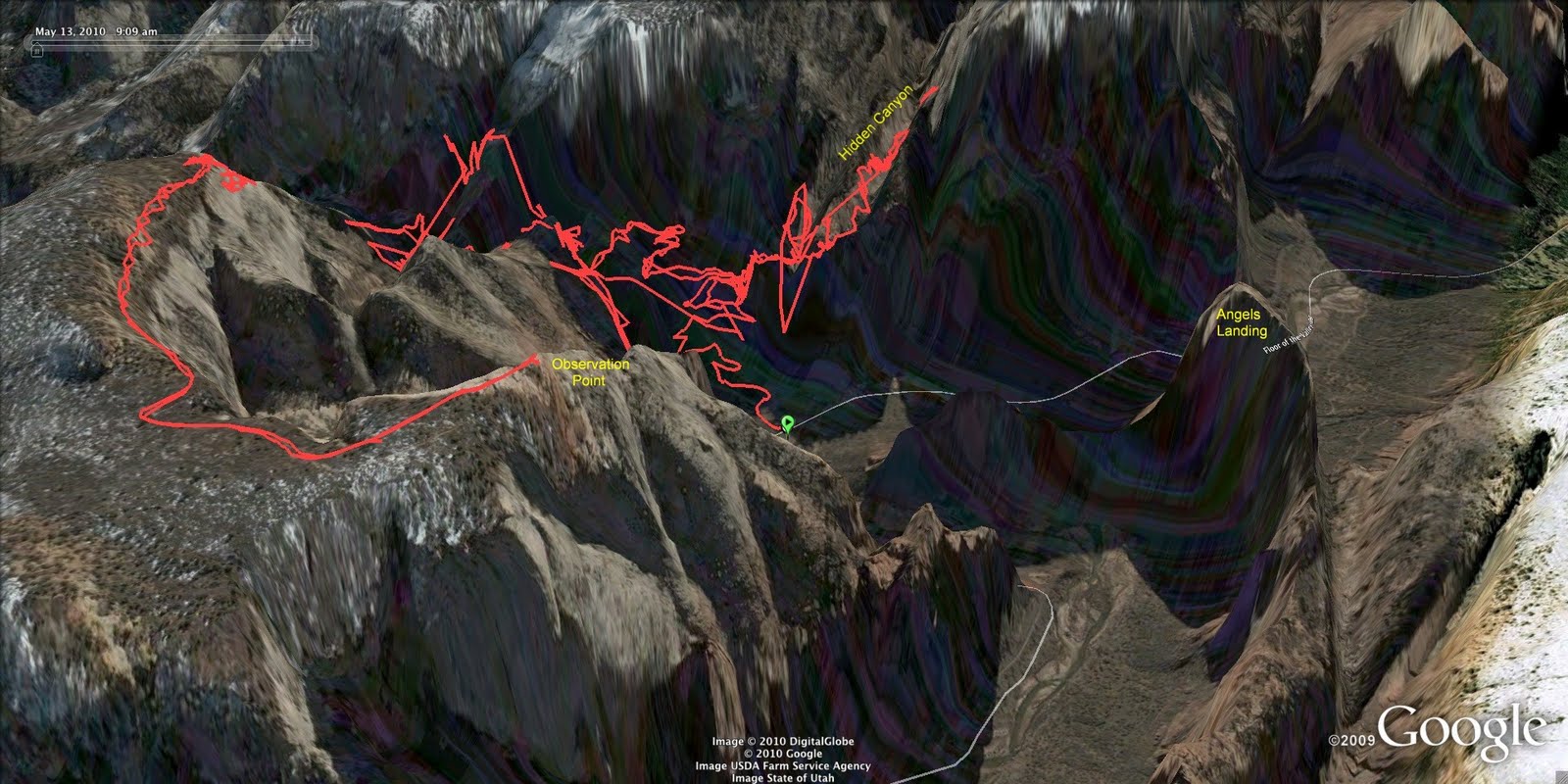
It was an 8 km trek to Observation Point and it was worth every meter. Behind me in my summit shot is the Zion Canyon and down below me in the middle is Angels Landing. I thought I was high on Angels Landing.
I met some friendly folks on top who I sat and had lunch with. They were two ladies who worked doing trail maintenance at the Grand Canyon. We shared our hiking stories. I stayed for about an hour and then headed back down thinking I would like to try Hidden Canyon. I passed by Echo Canyon and played around on the sandstone formations.
I love this shot! See the pool down below?
I hiked along quickly on the way down after Echo Canyon to give myself enough time to explore in Hidden Canyon.

HIDDEN CANYON

When I reached the fork in the trail, there were a few folks just heading in so I caught up with them and followed for awhile just to make sure I wasn't alone when I got to the chain section. As it turned out, it was steep but not near as scary as the Angels Landing chain section. You can see the hikers following the edge on towards the chains.
I let them go, and then hiked the chain section on my own.
I explored in the canyon for about a kilometer and then came to a gigantic rock that I didn't know how to get up and over. The others did, but I didn't see how they did it. I checked out what was around me and admired the colors in the walls.
It was looking like this would be close to a 20 km hike so I was quite content to be turning around and heading on out.
Instead of taking the shuttle from this stop, I walked along the river to the next stop which was about a nice 30 minute walk. That was where I saw the wall climbers. If you look closely you can see them!
This was an amazing hike to end my trip. I took my time leaving the Park area yet was thinking about that last beer in the fridge! It was a very warm evening, I sat out for a lengthy period enjoying the scenery and being very thankful for all I was fortunate enough to experience this week.